
Storm Austen Leaves Tens of Thousands Without Power as Storm Boelo Bears Down on the North

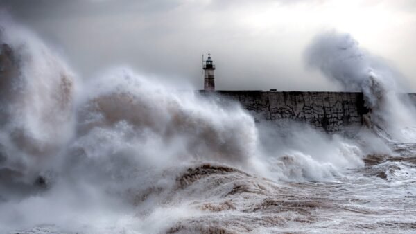
Tens of thousands of homes in south-west England spent Friday without electricity after Storm Austen, the first named storm of the season, battered Britain with gusts of up to 80mph — and forecasters warned the country would get only a brief respite before Storm Boelo arrives over the weekend to hammer the opposite end of the country.
The Met Office issued amber weather warnings for wind across Cornwall, Devon, the Isles of Scilly and Plymouth, in force from the early hours until 10am on Friday, alongside danger-to-life alerts for exposed coastlines, where towering waves and flying beach debris threatened sea fronts, coastal roads and properties. A gust of 76mph was recorded at St Mary’s Airport on the Isles of Scilly on Friday morning, according to The Times, as the storm’s core swept across the South West.
By Friday afternoon, more than 31,000 homes in the South West were still without power, The Sun reported, citing the National Grid, with outages concentrated in Cornwall and around Penzance. National Grid engineers were working through fallen trees, downed power lines and debris strewn across roads to reconnect households. The Times reported that tens of thousands of homes had been left without power as the storm moved through, with late-Friday figures putting the total at 31,000 properties in the southwest alone.
Schools bore the brunt of the disruption in the hardest-hit areas. Nearly 100 schools across Cornwall either closed entirely or opened late on Friday, according to The Sun, with 24 — including Beacon Academy, Mawnan School, Nine Maidens AP Academy and St Levan Primary School — shut for the whole day. Cornwall Council urged parents to check school websites before travelling. Schools in Guernsey were also closed, and ferry services to the Isles of Scilly were suspended as the Channel Islands came under some of the heaviest gusts.
Transport networks were thrown into disarray. Flights were cancelled, train schedules disrupted, and Great Western Railway imposed speed restrictions on routes between Devon and Cornwall until 1pm. Drivers in Devon and Cornwall were told to travel only if necessary amid reports of overturned vans, trees ripped from pavements and fallen power cables, while motorists in Essex battled flooded roads.
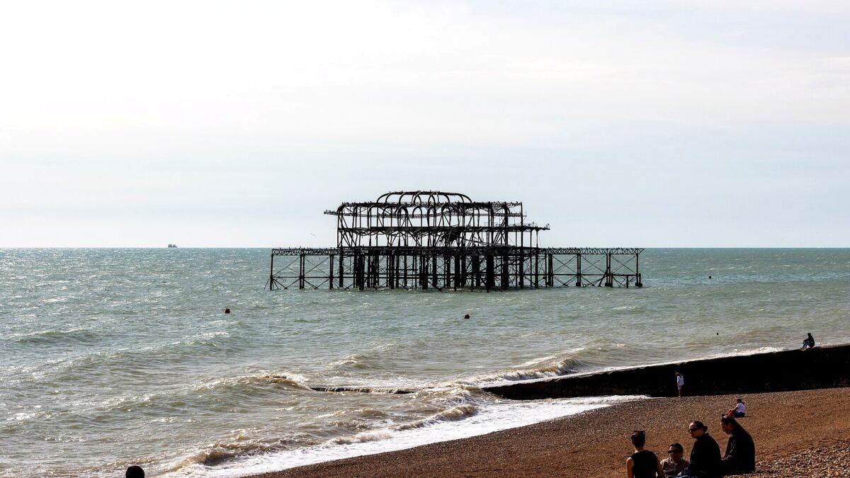
In Brighton, the storm’s giant waves tore at one of the most recognisable ruins on the English coast. Social media videos circulated on Friday showing part of the skeletal West Pier collapsing into the sea, The Times reported. The pier has been derelict and closed to the public since 1975; a fire gutted it in 2003, and its bare iron framework has stood as a seaside landmark ever since. Further sections of the structure are now missing, eaten away by the storm surf.
The damage was not limited to the coast. Haven Holiday Parks evacuated guests from both its Perran Sands and Riviere Sands sites in Cornwall, delaying Friday arrivals and offering affected families breaks at other parks or later dates. Zoos and safari parks across the country — including Chester Zoo, Marwell Zoo in Hampshire and Longleat Safari Park — closed for the day on animal-safety grounds, citing the risk of falling trees and debris.
Prime Minister Andy Burnham warned that the country should prepare for worse to come. Speaking at an event on civil preparedness, Burnham said the UK could face “a winter of greater flooding” and that Britain was living in a world where “unexpected events” were becoming “more and more common”, according to The Times. He said ministers were pressing ahead with “the conversation with people about being better prepared” for extreme weather.
The worst may not be over for the north of the country. Storm Boelo, the second named storm of the 2026/27 season, is due to sweep across Northern Ireland, Scotland and parts of northern England on Saturday and Sunday, bringing strong winds, heavy rain and low temperatures to what forecasters described as the opposite end of the country from Storm Austen.
The Met Office has issued yellow wind warnings covering the whole of mainland Scotland, the Western Isles, Orkney and the far north of England, in force from Saturday afternoon through to 9pm on Sunday. Forecasters warn of widespread gusts of 55-65mph, reaching 70-80mph in exposed coastal areas and on high ground. A separate yellow warning for wind covers Northern Ireland from Saturday evening into Sunday afternoon, with gusts of 50-60mph widely and up to 65-75mph in exposed places, The Sun reported.
Deputy chief forecaster Chris Bulmer said Storm Boelo would bring “strong winds and heavy rain to Northern Ireland, Scotland and parts of northern England over the weekend, impacting the opposite end of the country to Storm Austen,” adding that “the strong winds will be accompanied by heavy rain, making for an impactful weekend of weather.”
Rain will add to the misery in the north. A yellow warning for rain covered parts of Scotland into Saturday, with 20-40mm expected widely and isolated totals of up to 80mm possible in some spots, raising the risk of flooding and travel disruption. The paired storms are expected to produce a “weather bomb” — a powerful system driven by a rapid drop in atmospheric pressure — just as the half-term holidays begin, threatening widespread travel chaos for families setting off on weekend breaks.
Analysis: Why It Matters
Back-to-back storms are the real story
Britain is well practised at weathering a single Atlantic storm. What makes this weekend unusual — and genuinely dangerous — is the one-two punch: Austen slamming the South West on Friday, Boelo hammering the North barely 24 hours later, with only a brief respite early on Saturday in between. That compression matters enormously for the emergency response. Repair crews that spent Friday night restoring power in Cornwall will have no recovery window before the next system starts knocking down trees in Scotland. National Grid engineers, council highways teams and the Environment Agency’s incident rooms face a rolling, two-front crisis rather than a single event they can clear up and move on from.
Forecasters call the mechanism a “weather bomb”: an explosive deepening of low pressure as the storms interact with a powerful Atlantic jet stream. The Met Office noted that Austen intensified rapidly for exactly this reason. These systems are not unprecedented — Britain’s autumns have always been stormy — but the clustering is what turns severe weather into a national emergency. A single amber warning is a local disruption; two named storms in 48 hours is a test of the country’s entire resilience machinery, from electricity substations to school closure lists.
Burnham’s “winter of greater flooding” is a political signal, not just weather chat
Prime ministers do not casually warn of “a winter of greater flooding” at civil preparedness events. Burnham’s remarks, reported by The Times, look like deliberate expectation-setting: ministers clearly believe this season could be worse than recent ones and want the public — and the infrastructure operators — primed. The language of “unexpected events becoming more and more common” is the language of a government trying to normalise resilience spending and preparedness behaviour before the next crisis lands, rather than apologising after it.
It also carries a warning for households: insurance, flood defences, and emergency planning are about to become kitchen-table topics again. For a prime minister, invoking civil preparedness is never free — it invites scrutiny of whether flood defences are actually funded, whether the power grid can take repeated hits, and whether councils have the budgets to keep responding. The rhetoric will be judged against the reality of every subsequent storm this winter.
The power grid is the hidden vulnerability
The most politically consequential number in this story is not the 80mph gust or the school closures — it is 31,000 homes without power. Electricity failures are the disruption that cascades: no power means no heating, no cooking, no phone charging, no broadband, and for medically vulnerable people, no powered equipment. The National Grid’s engineers faced a brutal geography of damage — fallen trees and power cables across rural Cornwall — and the restoration effort will still be under way in places when Boelo hits the north.
Britain’s distribution networks were designed for a climate with occasional storms, not back-to-back named systems arriving within a day of each other. Every winter that brings clustered storms raises the same uncomfortable question: is the grid being hardened fast enough? The industry will point to the speed of reconnections; critics will point to the fact that the same stretches of the South West lose power in every major storm. Boelo will now test the northern networks in exactly the same way.
The West Pier’s collapse is symbolic damage
The images of part of Brighton’s West Pier falling into the sea will travel further than any warning graphic. The pier — derelict since 1975, gutted by fire in 2003 — has stood as the south coast’s most photographed ruin, a monument to Victorian ambition slowly being reclaimed by the sea. Each storm takes a little more of it, and Storm Austen’s giant waves have visibly accelerated the process.
There is no practical fix; the structure is beyond restoration and was never going to survive many more decades of Atlantic assault. But its gradual disintegration is a vivid, photogenic measure of what increasingly violent coastal weather does to Britain’s shoreline infrastructure — piers, sea walls, promenades, coastal railways — that cannot simply be moved inland. Coastal councils watching the West Pier footage will be doing the maths on their own sea defences this weekend.
Half-term timing turns weather into an economic story
The calendar could hardly be worse. With schools breaking up for half-term, millions of families are travelling this weekend — to holiday parks like the Haven sites that have just been evacuated, to the zoos that have just closed, to ferries and flights that are being cancelled. The travel industry, still recovering from a bruising year, faces a weekend of mass disruption, refunds and rebookings.
There is a preparedness lesson here too. Storm Austen’s amber warnings were issued well in advance, and the Haven evacuations show operators taking them seriously — a marked change from the era when weather warnings were treated as background noise. The question is whether travellers heed them. The Met Office’s “do not travel if possible” guidance only works if people believe the warnings, and Britain’s warning fatigue — after years of yellow alerts that came to nothing — is the silent variable in every forecast.
What to Watch Next
- Storm Boelo’s landfall on Saturday evening: the yellow warnings for Scotland, Northern Ireland and the far north of England are the immediate focus — gusts to 80mph in exposed places and heavy rain could bring fresh power cuts, flooding and road closures. Watch the Met Office for any escalation to amber.
- Power restoration in the South West: how quickly National Grid clears the backlog from Storm Austen will be the first real test of the winter for the electricity networks. Any households still dark when Boelo arrives in the north will sharpen political scrutiny.
- Flooding in Scotland and the north: up to 80mm of rain in parts of Scotland, on top of saturated ground, is the classic recipe for river flooding. The Environment Agency and SEPA alerts over the weekend deserve close attention.
- The West Pier survey: engineers and the local authority will assess how much of the structure was lost to the sea. Expect drone footage and a fresh round of debate about whether anything should — or even could — be done to stabilise what remains.
- Burnham’s preparedness agenda: the prime minister has now publicly tied his government to winter resilience. Watch for funding announcements on flood defences, grid hardening and civil preparedness in the coming weeks — and for opposition parties demanding specifics behind the rhetoric.
Sources

About the Author — Abdul Mannan
Related Articles

Healey to Inject £20.4 Billion into State-Backed Lenders in Pre-Budget Growth Push, FT Reports
Chancellor John Healey will use next week's Budget to inject £20.4 billion of fresh capital into the National…

Burnham Promises Businesses Nearly £800 Million a Year of Relief in Pre-Budget Red-Tape Offensive
Prime Minister Andy Burnham has promised businesses almost £800 million a year in savings from simpler paperwork and…
Storm Austen Slams South-West England: 18,000 Homes Lose Power, Zoos and Holiday Parks Shut as 80mph Winds Batter the Coast
Storm Austen, the first named storm of the season, brought 80mph gusts, an amber 'danger to life' warning…